|
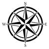
Hello and welcome back to another week of my blog! This week I will be taking six more lessons from my class on SkillShare. Furthermore, this will involve learning a bit more about the history of maps, planning my map, and beginning the process of making my map. This blog will be filled with information and fun so buckle up! Day 1: "The Map Inside" In this lesson, I learned a new word used with maps, simulacrum. This is a very weird and fascinating word, and the definition definitely suits that. Simulacrum, a term popularized by French philosopher Jean Baudrillard, is a visual creation designed to trick the eye by presenting a likeness of something real. In more simpler terms, it is a fantasy version or representation of something that is real. For example, Disneyland is a form of simulacrum. It took meticulous planning to make it seem as magical as it is to so many. The different places are placed in locations that make it seem like you are actually there. Similarly to fantasy maps, simulacrum allows our minds to escape the bustle and stress of life and take a journey inward to a magical place. One map that I learned about in this lesson that displays simulacrum at its finest is a map of "fairyland" created by Bernard Sleigh. This beautiful map places all of the famous fables, myths, and nursery rhymes into one tangible piece of art. Thus, if you look at the map, you can see all of your favorite childhood stories, and you feel like you are actually a part of that world. After scanning over the map, it is inevitable that you will see at least one recognizable story interlaced with the other images. So far, I have only talked about what the map shows, but there are also some tricks Sleigh used to make this map so memorable. If you look in the center of the map, you will find a myth of the Norse Gods, Asgard surrounded by the Sea of Dreams. This draws parallel to one of the maps from an earlier blog post, Psalter Map. The Norse Gods look down upon their kingdom in the same way that Jesus did in Psalter Map. A lot of times, fantasy maps and religion share ties and easily relate to each other. This whimsical map shows secrets of our beliefs and opens the doors to our imagination.  "Fairyland" displays countless different myths and nursery rhymes to the reader Day 2: "Journey and Destination" Today, I learned about how adventure is an important part of a map, and I explored three different settings portrayed through maps. Furthermore, these three settings are: treasure island, hell, and Thames River. I will explain how each map brings the reader on a journey through a world of its own. The map of treasure island correlates with the book, Treasure Island, by Robert Louis Stevenson. This book was set in the 1750's and brings the reader on the hunt for treasure. The map is supposed to feel like an artifact from the time that was used by explorer, William Bones. This map allows the reader to have a first-person perspective and feel like they are on the journey with the characters. This map speaks to the little kid in all of us, hungry for adventure. I learned about a couple different maps of hell that relate to the poem, "Dante's Inferno" by Dante Alighieri. This poem takes the reader on a journey through the nine circles of hell. It is filled with detail and calls the imagination similar to J.R.R Tolkien. The map is uniquely designed and shows the story through nine concentric circles. The circumference of each circle shows the level of wickedness. Another map created by Sandro Botticelli in response to the poem shows a more realistic version of the world. It turns the symbolism into a distorted world filled with evil. Lastly, the map of the Thames River in London drawn by Stephen Walters creates a world that is both a fantasy world and a reality. This map has a distinctive voice that projects insight and knowledge. Moreover, Walters passes through different areas of London whilst telling the story of humanity. Also, it shows elements of infrastructure in London and how the city has changed over time. Basically, it shows how real places have pieces of fantasy as well. All-in-all. this map takes the reader on a unique journey through the developing city of London. Day 3:"Metaphors and Monsters" This lesson was about how cartographers use metaphors to bring their maps to life. Maps can act as metaphors rather than just the connection of data. For example, the map in Harry Potter, Marauder's Map, is used by Harry to see what each character is doing. Additionally, it has a deeper theme. It shows the true intent of the characters and shows their mischievous side. Many fantasy maps don't focus on geography, but they focus on the story. A map from The Princess Bride isn't supposed to be used as a map but as an idea of the character's journey and the layers of the book. Another example of this is Persuasive Cartography. This form of cartography is commonly used during war times. It has a villainous appeal and brings out a sense of evil. In these maps, artists use animals to show conflicts and as metaphors. For example, Fred Rose drew a map of Russia with an octopus extending its tentacles over the land. This map was showing the beginning of a war between Russia and Turkey, and the octopus represents the nature of evil and its power. After this, an octopus became a common symbol in maps. It represented the influence of a major oil company on the US government, the power of rich landowners in Europe, and the tentacles of Prussia reaching towards Europe. Metaphors are used all over the place in maps, and they are a powerful tool of the imagination. Day 4: "Searching for a Utopia" This lesson was about utopia. By definition, utopia means no place or a place of our imagination. The idea of utopia became popularized in 1516 when author Thomas More wrote a book called Utopia. In this book, a traveler meets an ambassador for the king. They have dinner, and while eating, the traveler tells the ambassador of an island he traveled to. This island was "perfect". There were 50 city-states, and each of them shared a language, customs, and laws. Every person there was working for the common good, and together, they created paradise on earth. The traveler told the ambassador to tell the king of this place because he believed that Europe could be the same. Unfortunately, More knew that this was impossible. He wrote this book to sting the reader at the end. He knew that a utopia was impossible, and he wanted to make sure everyone knew that. However, utopias exist in our minds. Our collective imagination creates a utopia that sits on the border of reality and imagination. I will be creating a utopia of my own in this project, and I can't wait. Day 5:"Planning a Utopia" Today, I finally started the planning process of my map.This map should represent what my perfect utopia looks like. To start, we planned out four different things to find what our utopia would be. It should be a geographical region that holds memories. Furthermore, it should represent familiar things and not be your "dream vacation". Most likely, this place would be from your childhood, and for me, it is. I chose to create a map of my old house, second house to be exact. I lived there from about age two to twelve, and it will forever be my home. Next, we planned what the landscape will look like. I made a list of all the memorable areas that I loved as a kid. This includes the long, winding driveway that led up to the vast blacktop, the "thick forest" that was wedged between two areas of the driveway (AKA "Australia"), The small, dirty creek, the woods surrounding the house, The humongous bush inside of "Australia", The other two neighboring, humongous bushes , the long, brick sidewalk, and the large, green yard. That was a very long list of all the important parts of my old property After, we planned specific landmarks we wanted to include in our map. These are places that hold specific memories in your heart and are important to you. These are the not-a-tree tree house, the shed covered in ivy, the "snow bush", the raised bed gardens, the grand wall, the mountain biking trail, the two trees with the slack-line and the swing, the old barbie car, and the brick wall covered in chalk. These are all of my favorite places that I couldn't have lived without. Lastly, we planned the happy things we wanted to incorporate into the map. This includes events, things, and interactions. A few things came to mind when thinking about his which are, the rain on a summer's day, creating chalk towns on the driveway, the blooming flowers of spring, the creating of new foods and drinks with the herb garden, the tennis balls littered in the trees, and Peytons' fireworks . That is all of the planning that was involved in this process. When coming up with these ideas, I was having many flashbacks and memories that I can't wait to recreate. Some design goals that we were given for this map were to create an immersive map, to create questions, to represent your personal style, to show some things and hide others, and to create an artifact of some sort. I can't wait to use all of this new knowledge and create a map of my own. Day 6: "Gathering References" So, today, I began to gather references for my map. In other words, I found a couple different maps to draw inspiration from. Each map I chose is actually from the book I am reading, All Over the Map: A Cartographic Odyssey, which I will be posting about next week. These are maps that I liked a certain aspect of that I want to use in some way on my map. Also, this week, I decided not to do a seventh day because I wanted to have all of the drawing ones together, so that will have to wait for part 3. Anyways, I chose eight different references which I will now be showing you. 1. William Hack's map of South America  This is a map of South America drawn to show a sailing route, and it has a very fascinating history. However, if you want to hear the whole story, you'll need to tune in next week. Anyways, I really like the overall style of this map. I like how Hack used different colors on different countries but left the centers white. I also like the compass rose because it isn't just the normal boring style, and it adds a pop to the map. Additionally, I liked the wording style Hack uses in the map. Although it is hard to see in this picture, he actually writes words along the coastlines in a very small font. This isn't the overall style I'm going to be using, but I will definitely be incorporating bits and pieces into my utopia. 2. Matrakçı Nasuh's map of Istanbul  This map drawn by Nasuh depicts Istanbul during the time of the Ottoman Empire. I am going to use a couple different elements from this map. First, the way the houses and landmarks are drawn are similar to how I might draw my own. It's detailed, but at the same time, it is fairly vague. If you look closely, you will see that each half has a different orientation. Originally, seeing it like that creates an uneasy feeling for me. I began to grow more fond of it, and if I find the right opportunity, I might incorporate that. I also enjoy the overall style of the map and will definitely be using this as a guideline. 3. Anna Beek's map of the Battle of Toulon  This map caught my eye for one main reason, the inset maps. The bigger map is a landscape view, and that shows a lot of detail. But, the inset map shows the area from a bird's eye view. This is a perfect way to mix a more illustrative map with a touch more regular map feel. It almost gives a blueprint of the area, and I think that will come in handy for my map. It is a way to show more detail without overcrowding the main map. 4. Max Gill's map about the tea industry  I think this map is perfect to use for the main idea of mine. I really like the overall style, and I will be using a lot from this. Gill uses little illustrations to show certain places and uses a lot of symbology. Gill also uses tons of boxes to give facts about each area. This will work with my map because I can describe the significance of each place with both words and pictures. This map has a fantasy feel to it even though it is real, in a sense. This is a good example of the use of simulacrum, something I hope to use in my map. 5. Mauriel Parry's map  This map immediately caught my eye. It was definitely not the ideas shown in this piece of persuasive cartography, but it was the art of it. Parry makes the building appear to be 3D and really makes it come to life. This is a fantasy map at its best. You can see the shape of the human skull as the land, the sea monsters lurking in the surrounding waters, and the puffs of clouds filled with mysteries. My map is not going to include this much detail, but I want it to look somewhat similar to this. You can't see it in the picture, but the border is filled with words describing the map, which I think is a very interesting idea. I will be sure to use some of the elements of this map in my future map. 6. Anton Thomas' map of North America  This map in its entirety is actually of every part of North America, but I wanted you to be able to see a little bit more detail. I really enjoy the looks of this map, and it is really pleasing to look at. I think it has a very intimate, child-like feel to it. It gives the sense of a home, and the drawings add a perfect amount of detail. Of course, my map would not be quite as detailed. Thomas uses a great font to enhance the map, and he uses illustrations to highlight important parts of the map. These drawings not only show important locations, but they also deliver pieces of the culture of that area. I think this idea could be fun to play with, and I will surely be using the style of this map in my own.
After doing all of this preparation, I feel ready to start a fantasy map of my own. Over these two weeks, I have learned a lot about the art of creating maps, and I can't wait to test that knowledge. I know that it's not going to look perfect after just one try, but I think I can make it look pretty okay. After observing all of these maps and pulling ideas from them, it can't turn out that bad. Tune into Taking Action Pt. 3 in a couple of weeks to see my rigorous planning be used in my map. See you next time with another blog post!
0 Comments
Leave a Reply. |
Archives
September 2021
Categories
|


 RSS Feed
